Category:Old county maps of County Durham
Jump to navigation
Jump to search
Ceremonial counties of England: Bedfordshire · Berkshire · Buckinghamshire · Cambridgeshire · Cheshire · Cornwall · Derbyshire · Devon · Dorset · Durham · East Riding of Yorkshire · Essex · Gloucestershire · Hampshire · Herefordshire · Hertfordshire · Kent · Lancashire · Leicestershire · Lincolnshire · Norfolk · Northamptonshire · Northumberland · Nottinghamshire · Oxfordshire · Rutland · Shropshire · Somerset · Staffordshire · Suffolk · Surrey · Warwickshire · Wiltshire · Worcestershire
City-counties:
Former historic counties: Cumberland · Huntingdonshire · Middlesex · North Riding of Yorkshire · Sussex · West Riding of Yorkshire · Westmorland · Yorkshire
Other former counties:
City-counties:
Former historic counties: Cumberland · Huntingdonshire · Middlesex · North Riding of Yorkshire · Sussex · West Riding of Yorkshire · Westmorland · Yorkshire
Other former counties:
Media in category "Old county maps of County Durham"
The following 14 files are in this category, out of 14 total.
-
 Durham - John Speed Map.jpg 6,497 × 5,015; 5.08 MB
-
 John Speed - Map of Durham - 001.jpg 3,000 × 2,236; 2.62 MB
-

-
 Maps of England circa 1670, Durham 13 of 40 (13433688254).jpg 6,449 × 4,971; 3.82 MB
-
 17th Century map of County Durham.JPG 2,048 × 1,536; 1.01 MB
-
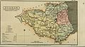
 Aikin(1800) p060 - Durham.jpg 1,936 × 1,172; 381 KB
-
 A topographical dictionary of the United Kingdom (1808) (14598470258).jpg 3,040 × 1,700; 1.12 MB
-
 Gray1824.durham.jpg 803 × 952; 139 KB
-

-
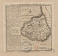
 Pigot and Co (1842) p2.094 - Map of Durham.jpg 2,144 × 1,310; 897 KB
-
 BOYLE(1892) p8 - County Durham map.jpg 5,539 × 4,642; 7.14 MB
-
-

-
 Episcopatus Dunelmensis vulgo the Bishoprike of Durham - CBT 6596138.jpg 5,819 × 4,624; 7.19 MB


.5.(51).jpg)
.jpg)

_p060_-_Durham.jpg)
_(14598470258).jpg)

.jpg)
_p2.094_-_Map_of_Durham.jpg)
_p8_-_County_Durham_map.jpg)


